Softshell Clam Survey of Upper Penobscot Bay, 1966-67
CASTINE
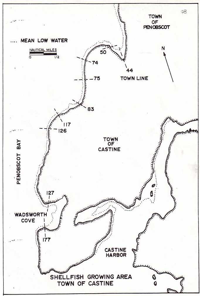
Morse Cove (Stations 44 - 50) This portion of Morse Cove was considered a mirror image of the half located in the Town of Penobscot. Conse- quently, the same estimates for standing crop and value are used.
Castine, West Shore (Stations 51-74) This shoreline of Castine is typified by a narrow band of intertidal zone containing; rock outcrops and scattered "cobble sized" stones. See Figure 29. Mechanically made estimates of the existing intertidal zone derived from nautical charts totaled 28 acres. This figure was reduced to 24 acres of possible clam producing flats after deductions were made to account for rocky areas. Thirty-five (35) shellfish samples from these growing areas were collected, which indicated a possible commercial population of 700 bushels with a value to the community of $12,600 to $37,800.
Castine, West Shore (Stations 75 - 126) This section of shoreline in the Town of Castine is a continuation of the type encountered in the area covered by Stations 51 - 74. The intertidal zone, again, is a narrow band paralleling the shoreline. There were no apparent modi- fications noticed along this stretch of beach to distinguish it from any other covered in the immediate area. Calculations made from nautical charts by planimeter showed the intertidal zone to contain 35 acres. Deductions made for the rocky condition of the beach reduced the potential clam growing area to 30 acres. Sixty samples were collected in the area on the 11th of August, which indicated a commercial population of 2,200 bushels with a community value from $42,600 to $118,800. See Table 5.
Wadsworth Cove (Stations 127 - 177) This cove was the last to be surveyed on the mainland. The resource survey was restricted to the cove proper since conditions of the outer fringes, evidenced by high densities of cobble-sized stones, appeared unsuitable for clam production. Carpets of smaller stones also covered the upper portion of the intertidal zone throughout many sections of the beach.
Planimeter readings made from nautical charts showed an intertidal zone of 56 acres. This total acreage was reduced to 50 when adjustments were made to account for the rocky patches throughout the clam growing areas. This study was conducted on the 11th of August, and the results obtained from soft-shell clam samples of 62 stations indicated a potential commercial population of 4,200 bushels with a community value from $82,600 to $226,800.
Conclusion Of all the areas surveyed in the Town of Castine, it is apparent that Wadsworth Cove is the most productive and would aid more in boosting the economy of the community than all the other surveyed areas of the town combined.
Results of the soft-shell clam resource survey in the Town of Castine show a total standing crop of 7,700 bushels with a community value from $149,900 to $415,800.